Saturday, 31 December 2011

Blue deposits

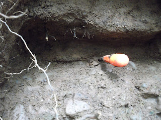
I have now cleared more of the material shrouding the blue deposits at Stainton


Some of the red you can see is caused by the dust from the deposits above but there are a lot more of the red veins than first thought.
The clay both red and blue is extremely tough almost rock like, and appears greasy.


There is quite a lot of small pieces what i think is Mercia mud stone in the red clay


The blue clay has very little covering it in this part of the dig.


The image below i think shows two separate red brown layers, something we did not notice with the  cores taken with the auger.


I have dug a 1.5 metre test hole about 15 metres down stream, with no sign of the blue deposit, so it seems this is a high point in the blue deposit at least as far as the beck side is concerned.


This image shows the site the last auger work was carried out just to the bottom left of the pic, we reached 3 metres without encountering the blue deposit or the rock head.
Posted by Picasa

More magnetic rock found in the Stainton gravel beds.

Unknown rock dug from the Stainton gravel beds, the magnets used are not rare earth magnets.


The pink magnet can be seen stuck to the rock    The Stainton gravel beds


Tuesday, 27 December 2011

The true superficial Geology of south west Cleveland north east England.And a map of the locations of my excavations, and locations of the Stainton gravel beds

This excavation shows about 400mm of top soil then the ever present friable red-brown loamy clay with minor pebbles.


Posted by PicasaAs far as i know this red brown deposit covers this whole area sometimes very thick, what i am begining to understand is this deposit is so close to the surface in places it makes the ground around here glow red as the sun lowers and the ground is wet.

The diagram above shows what i now know to be the true superficial geology both to the north and south of the Cleveland dyke in the south west area of Cleveland north east England

Agar 1954 on the deposits in the south west area of Cleveland.

Agar covered in detail the deposits to the north of Stainton created by the ice-dammed water-body that is said to have stood far below the 50 metre elevation of the Stainton site's.  Neither of the papers i have now looked at explicitly cover the south west area of Cleveland, but Agar ( 1954) maps the area as being till- covered with no detail on other beds in the area.
I can now with some confidence state that Agar mapped the area wrong, the area is far from a till covered glacial mess in fact i am yet to come across anything that resembles a till deposit or indeed any glacial erratics on the surface, every area i have excavated is proof in itself that Agar mapped the area wrong, and in doing so tells me he never actually looked hard enough to have the right to map it at all .